
Where's the Monk Contest Challenge Continues : Part 2

01The Challenge Continues!
Our first Where’s the Monk contest wrapped up with a winner — read how José Manuel Echevarría Rubio, PhD Candidate in Marine Sciences at CICIMAR-IPN nailed his prediction — and now we’re back with a new stretch of ocean, a new contest, and a new deadline: July 20, 2026 at 11:59 PM PDT. Position updates revealed until July 13, 2026 at 11:59 PM PDT.
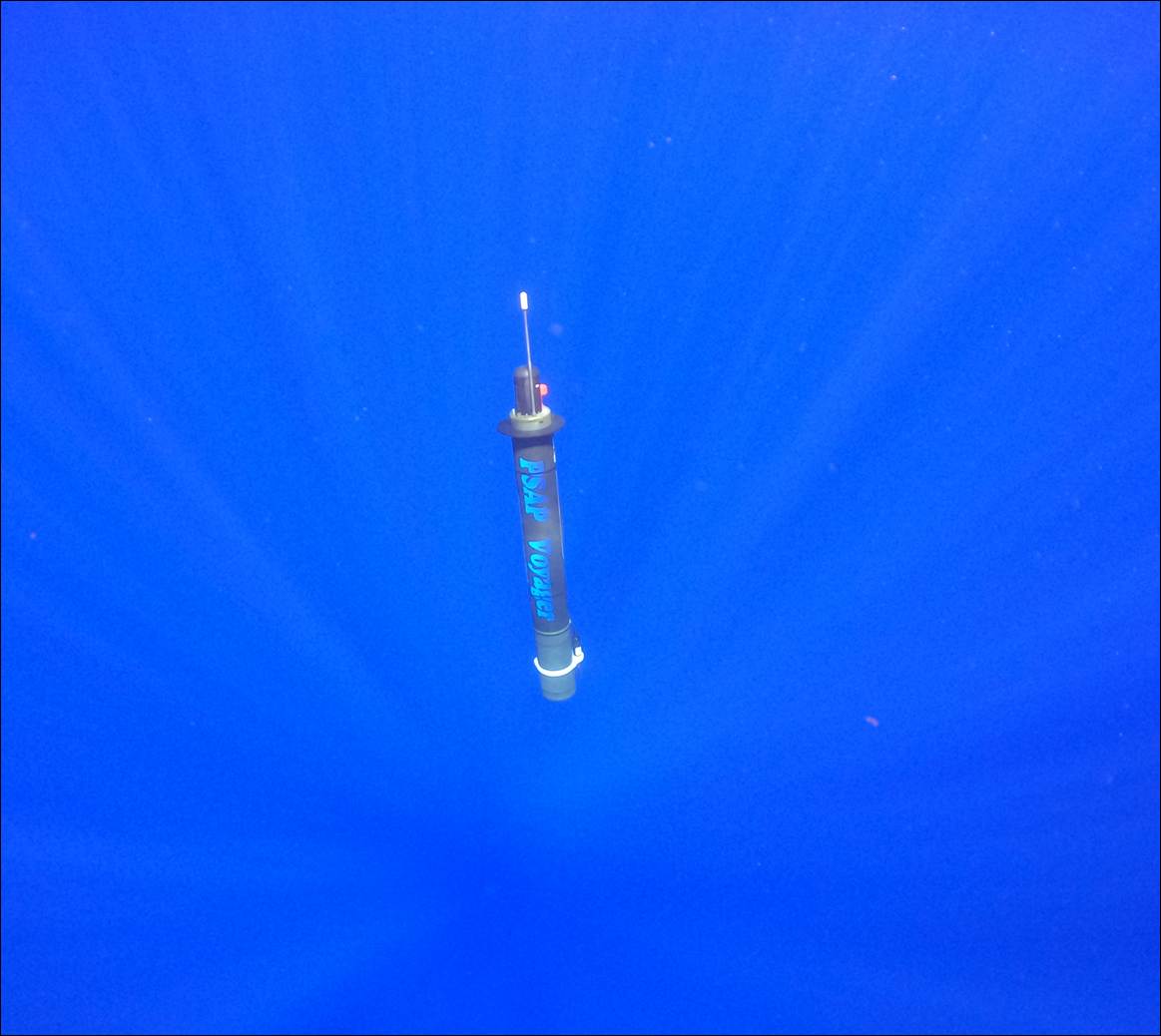
Somewhere along the North Atlantic, a profiling float named “The Monk” is drifting along — guided by currents, thermoclines, and the physics of the ocean. It’s one of Seatrec’s infiniTE™ floats, powered by thermal energy harvested from the temperature gradient between warm surface waters and the cold deep.
We know its last confirmed position. What we don’t know — and what we’re asking you to figure out — is exactly where The Monk will surface on July 20, 2026 at 11:59 PM PDT.
No hints. Just your read of the ocean, or your most inspired guess. Use the live tracker to study its trajectory. Dig into Gulf Stream data. Or go with your gut. Closest guess wins — ties broken by earliest submission.
Contest Brief
|
⏰ Contest Deadline July 20, 2026 · 11:59 PM PDT
|
🔍 Track Live 📅 Position Updates REVEALED Until July 13, 2026 · 11:59 PM PDT |
02What Is the infiniTE™ Float?
The infiniTE™ is Seatrec’s flagship ocean profiling float, designed to operate autonomously for years without battery replacement — harvesting energy from the ocean’s natural temperature gradient to power itself and collect critical oceanographic data on every dive cycle.
The Monk has been tracing the currents of the Atlantic, and its track tells a story of eddies, meanders, and the Gulf Stream system. Where it ends up next is yours to predict.
🏆
Win the Exclusive Seatrec T-Shirt

The winner receives this exclusive Seatrec “Infinite Energy · Deeper Insights” infiniTE™ T-shirt — limited edition, not for sale.
One Winner · Closest Coordinates Wins
03How to Enter
To win the shirt, study the tracker, make your prediction, and submit your coordinates. Closest entry wins. Ties broken by the earliest valid submission. We’ll announce the winner shortly after July 20th.
|
STEP 01 Study the trackerWatch The Monk’s trajectory at the live tracking link. Positions update through July 13, 2026 · 11:59 PM PDT. |
STEP 02 Make your predictionPick a latitude and longitude for where The Monk will surface on July 20, 2026 at 11:59 PM PDT. |
|
STEP 03 Submit coordinatesDrop your numbers into the official entry form before the deadline. |
STEP 04 Win the shirtClosest entry wins. Ties broken by the earliest valid submission. We’ll announce the winner shortly after July 20. |
The Series Continues
The Monk is Continuing its Journey
Our next contest is live. Same float, new currents, new prediction, new chance to win.


We have a Winner! Where's the Monk Contest: Part 1

01We have a Winner!

Our first Where’s the Monk contest asked one question: where would The Monk — one of Seatrec’s infiniTE™ floats, drifting along the North Atlantic — surface on July 5, 2026, at the closest time before 11:59 PM PDT? Predictions came in from around the world. Landing within 100 km of a float that’s been riding the Gulf Stream’s eddies and meanders for two weeks is genuinely hard — only four entries managed it. And when the Monk surfaced at 38.5626°N, 50.6690°W, at 3:27 PM PDT, one prediction stood closest of all, just 52 km away: José Manuel Echevarría Rubio, PhD Candidate in Marine Sciences at CICIMAR-IPN. (Shout out to his advisor, Dr. Guillermo Martínez-Flores!).
02The Results
José Manuel’s prediction (green) landed closest of all, with three more entries (yellow) also within 100 km — a genuinely tough target to hit. The rest of the yellow dots, spread across the map, show just how far the ocean can carry even a well-researched prediction.

The field made it a real race. Entries came in from around the world, and only four landed within 100 km of The Monk’s surfacing position — José Manuel’s the closest among them. Between them, the top four spanned Mexico, France, and both coasts of the United States — and all four are expert oceanographers.

Every entry, ranked by distance. Only four predictions worldwide landed within 100 km.
03The Winning Prediction
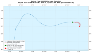 José Manuel’s prediction graphic.
Oceanographers describe moving water in two ways. The Eulerian view watches the ocean from fixed points, like a moored buoy reporting the current flowing past it, or a weather station reporting the wind. The Lagrangian view follows the water itself, like a message in a bottle going wherever the ocean takes it. Predicting The Monk is a classic Lagrangian problem: the float is a kind of diving bottle, and the question is where the ocean carries it.
That is what makes it hard. A Lagrangian forecast has to get many things right at once, and an error in any one of them can grow day by day:
- The mean current — the Gulf Stream is a geostrophic current, driven by sea surface height gradients, that can advect a float over 100 km a day in its core and far less just outside it. Get the current’s strength or position wrong and the whole trajectory shifts.
- Mesoscale eddies — warm-core and cold-core rings, tens to hundreds of kilometers across, that pinch off from meanders in the main current. A float caught in one gets trapped in rotational flow instead of advecting downstream — you can see exactly this looping behavior in The Monk’s track.
- Meanders — baroclinic instability makes the Gulf Stream snake rather than flow straight; whether a given meander sweeps the float north or south of the mean path can matter by hundreds of kilometers.
- Vertical shear — a profiling float spends much of its time below the surface, where current speed and direction can differ substantially from the surface, so the model has to resolve the current field at depth, not just at the surface.
- Chaotic dynamics — Lagrangian trajectories are sensitive to initial conditions; small position uncertainties amplify over time, the same underlying reason weather forecasts lose skill with lead time. A few kilometers of error early on can compound into a much larger miss days later.
- Data latency — position updates stopped on June 28; the prediction target was July 5. That’s seven days of dead reckoning, forecasting motion with no fresh GPS fix to correct against.
For me, it was like a fun programming exercise to also test the methodologies I use as part of my Ph.D.
— José Manuel Echevarría Rubio
A note for any Gen-AI submissions: the four closest entries came from oceanographers; AI-assisted guesses landed about six times farther out. The ocean is a complicated system! Join our webinar on August 18 and learn how the humans did it.
04The Interview
|
▶ CaTCH AN INSIGHT We met with José Manuel to talk about his prediction, his research, and the ocean itself. He’ll be sharing more during a webinar scheduled for August 18th. |
A QUICK SNIPPET BEFORE THE ACTUAL WEBINAR → |
What made you enter Where’s the Monk?
I saw the LinkedIn post, and part of my PhD thesis is modeling the Lagrangian transport of pelagic sargassum.
Walk us through your approach — what data and models did you use?
First, I got the whole track of the float since its deployment in the Gulf of Mexico. I used Copernicus Marine data — the Global Ocean Physics Reanalysis (GLORYS) current fields — with eight depth levels from the surface down to about 900 meters and built a cube of currents. I modeled the float’s trajectory going down into the deepest layer and back up to the surface every 11 hours, at about 0.1 meters per second for the descent and buoyant ascent rate.
I used two different datasets: a reanalysis for the hindcast (past ocean current data) and a forecast product for the actual prediction — which has more uncertainty, so I had to build an envelope of possible trajectories rather than a single path. I ran the simulations using the OpenDrift library, developed by the Norwegian Meteorological Institute. To validate the model, I did a grid search to tune all the parameters against the float’s own past positions (hindcast) before generating the forecast — the same validation approach I use in my PhD work with in-situ drifters for sargassum transport.
What was the hardest part of the prediction? What almost threw you off?
I had to use two different datasets — a reanalysis for the hindcast, the past ocean current data, and a different forecast product for the actual prediction. The forecast has uncertainties; it’s not as accurate, so I had to build an envelope of all the possible trajectories and adjust parameters accordingly. That was the trickiest part.
But it was a good exercise, because it’s the same approach I’m using right now to forecast the date and location of the sargassum beaching events.
The Monk surfaced 52 km from your coordinates. What did you get right?
I followed a good methodology — it wasn’t a lucky guess.
What first drew you to oceanography?
I grew up two blocks away from the Caribbean Sea, and the ocean has always been part of my life. My cousin, who is like my sister, studied marine biology and worked at the National Aquarium in Havana (now a Professor of Marine Science in Spain). I went to the Aquarium frequently with her, and she was the one who introduced me to this field of science.
You’re working on your dissertation — what’s it about, and what’s next for you?
My dissertation is on the factors that are controlling the proliferation of sargassum in the equatorial Atlantic — known as the Great Atlantic Sargassum Belt. First, I need to detect the sargassum, calculate the coverage, and simulate the trajectories. And the final part of my PhD is to try to find what is driving the blooms. Looking ahead, I want to stay right at that intersection, continuing to work on projects that combine remote sensing with ocean modeling to solve complex environmental challenges.
Any advice for people entering the next contest?
The first advice I’ll give is to have a solid ground truth — the past track the float actually took — and validate your model against that in-situ data before you attempt a forecast. Try to do the validation first. I do a lot of machine learning too, and it’s the same principle: you train your model, then validate on data the model hasn’t seen before
Plans after your dissertation defense?
I want to do a postdoc, maybe at the same institution — I’m not sure yet, but for sure I want it to combine remote sensing and physical oceanography. I’ve worked a lot with remote sensing already; for example, I did a project researching kelp forests on the West Coast, in the Pacific Northwest, and I really love kelp forests and the role they play in coastal ecosystems. I want to continue working on combining remote sensing with physical oceanography and ecological modeling. The first advice I’ll give is to have a solid ground truth — the past track the float actually took — and validate your model against that in-situ data before you attempt a forecast. Try to do the validation first. I do a lot of machine learning too, and it’s the same principle: you train your model, then validate on data the model hasn’t seen before
05What’s Next
José Manuel takes home the exclusive Seatrec “Infinite Energy · Deeper Insights” infiniTE™ T-shirt — and he’s not done. He’s going to compete in the next contest, and on Tuesday, August 18, 2026, at 9:00 AM PDT, he’ll join Dr. Paul Chamberlain, Postdoctoral Researcher at Scripps Institution of Oceanography, for our webinar “Finding The Monk: How to Predict Where the Ocean Takes a Float” — a walkthrough of real trajectory-prediction techniques, including how the winning forecast came together. José Manuel will defend his Ph.D. thesis early August, and by the time of our webinar, he will be Dr. Manuel.
The Series Continues
The Monk is Continuing its Journey
Our next contest is live. Same float, new currents, new prediction, new chance to win.
|
Mission Brief The Monk is drifting.On June 23rd, the Monk was at 39.1239°N, 55.4052°W — carried by currents, thermoclines, and the physics of the deep. |
01The Challenge
Somewhere in the North Atlantic, a profiling float named "The Monk" is drifting — guided by currents, thermoclines, and the physics of the ocean. It's one of Seatrec's infiniTE™ floats, powered by thermal energy harvested from the temperature gradient between warm surface waters and the cold deep.
We know its last confirmed position. What we don't know — and what we're asking you to figure out — is exactly where The Monk will surface on July 5, 2026 at 11:59 PM PDT.
No hints. Just your read of the ocean, or your most inspired guess. Use the live tracker to study its trajectory. Dig into Gulf Stream data. Or go with your gut. Closest guess wins — ties broken by earliest submission.
Contest Brief
|
📍 Last Confirmed Position ON 6/23/26 39.1239°N, 55.4052°W ⏰ Contest Deadline July 5, 2026 · 11:59 PM PDT |
🔍 Track Live 📅 Position Updates REVEALED Until June 28, 2026 · 11:59 PM PDT |
02What Is the infiniTE™ Float?
The infiniTE™ is Seatrec's flagship ocean profiling float, designed to operate autonomously for years without battery replacement — harvesting energy from the ocean's natural temperature gradient to power itself and collect critical oceanographic data on every dive cycle.
The Monk has been tracing the currents of the Atlantic, and its track tells a story of eddies, meanders, and the Gulf Stream system. Where it ends up next is yours to predict.
🏆
Win the Exclusive Seatrec T-Shirt
The winner receives this exclusive Seatrec "Infinite Energy · Deeper Insights" infiniTE™ T-shirt — limited edition, not for sale.
One Winner · Closest Coordinates Wins
03How to Enter
|
STEP 01 Study the trackerWatch The Monk's trajectory at the live tracking link. Positions update through June 28, 2026 · 11:59 PM PDT. |
STEP 02 Make your predictionPick a latitude and longitude for where The Monk will surface on July 5, 2026 at 11:59 PM PDT. |
|
STEP 03 Submit coordinatesDrop your numbers into the official entry form before the deadline. |
STEP 04 Win the shirtClosest entry wins. Ties broken by the earliest valid submission. We'll announce the winner shortly after July 5. |
04Coming Soon: Float Modeling Webinars
Seatrec will be hosting webinars on real float-modeling techniques — ocean current analysis, Argo float data, and trajectory prediction with public datasets. Stay tuned for dates.
Drop Your Coordinates
Ready to Outguess the Ocean?
The Monk is waiting to be found. Closest coordinates win.
Submit Prediction →Open Live Tracker
Contest run by Seatrec. No purchase necessary. Open to residents worldwide, ages 13+. Entrants under 18 must have parental permission. Void where prohibited. Winner contacted by email.
Seatrec Wins $75,000 from DOE to Advance Thermal-Powered Profiling Float to Measure Zooplankton
Seatrec Wins $75,000 from DOE to Advance Thermal-Powered Profiling Float to Measure Zooplankton
Partnership with ASL Environmental Sciences introduces a new capability for profiling floats to acoustically measure zooplankton biomass and its vertical distribution
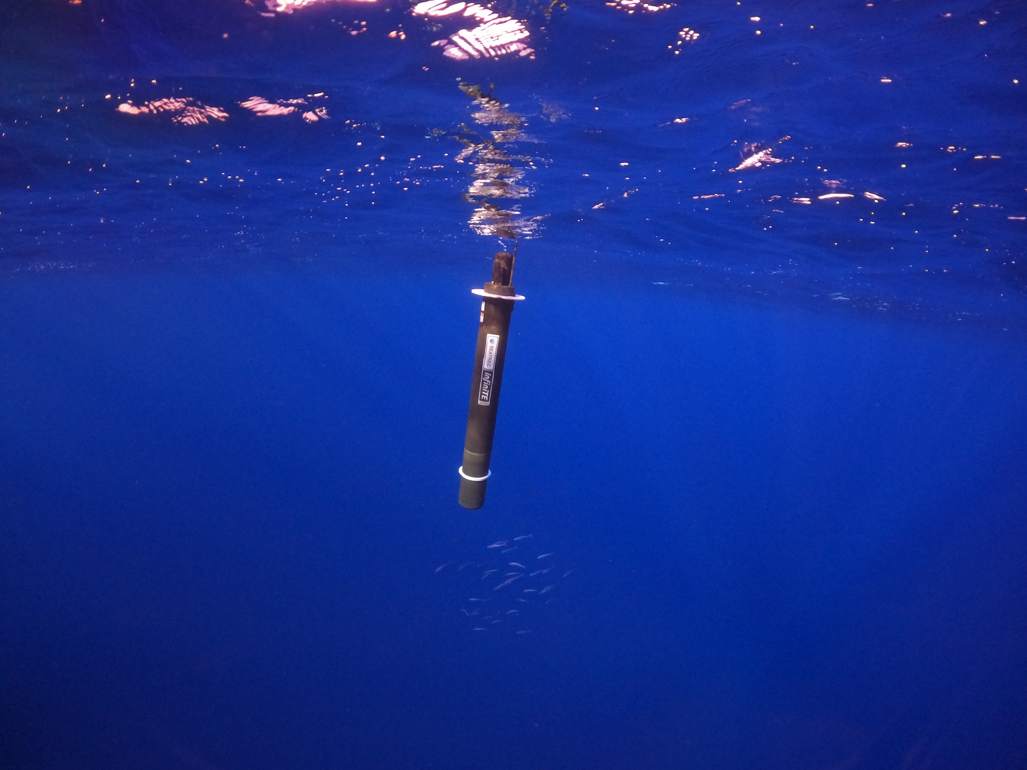
VISTA, Calif. — June 24, 2026 — Seatrec, a leader in thermal-powered profiling floats, has been selected as a winner of the DEVELOP Phase of the U.S. Department of Energy's (DOE's) Powering the Blue Economy™: Power at Sea Prize, earning a $75,000 award. The company is integrating ASL Environmental Sciences' Acoustic Zooplankton Fish Profiler (AZFP-pico) onto the infiniTE™ float powered by ocean thermal energy with a goal to measure vertical profiles of zooplankton and mesopelagic biomass. Seatrec previously won the CONCEPT Phase of the same competition in November 2024 with a $10,000 award.
"Measuring vertical profiles of zooplankton has been a dream for oceanographers," explains Yi Chao, Ph.D., Seatrec's founder and CEO. "Advancing to the DEVELOP Phase, and doing so alongside ASL Environmental Sciences, we are closer than ever to filling one of the most critical knowledge gaps in ocean science."
"This is genuinely uncharted territory," said Julek Chawarski, Ph.D., Biological Oceanographer at ASL Environmental Sciences. “The integration of ASL’s AZFP-pico with a long-endurance autonomous profiling platform could unlock an unprecedented view of meso- and bathypelagic scattering layers, providing persistent, basin-scale observations that have long remained beyond the reach of ocean science.”
Seatrec's infiniTE™ float converts ocean temperature gradients into electricity using phase-change materials, enabling long-endurance missions with profiling as frequently as every few hours. That sampling frequency is critical for capturing the diurnal behavior of zooplankton and mesopelagic organisms central to the biological carbon pump. The AZFP-pico provides quantitative assessment of meso- and bathypelagic biomass, while an integrated CTD captures physical oceanographic context, together delivering high-frequency, long-duration observations that ocean science has not had before.
The Power at Sea Prize, one of DOE's competitive programs, recognizes innovative marine energy concepts that could feasibly power blue economy applications, such as ocean-observing devices, aquaculture installations, and storm tracking systems.
DEVELOP Phase winners refine their technologies with support from industry mentors, networking opportunities, and targeted training, competing for a share of a $1.7 million final prize pool.
This milestone reinforces Seatrec's commitment to driving sustainable innovation in ocean technology and its mission to contribute to a thriving blue economy while addressing critical challenges in marine resource management and climate science.
ABOUT SEATREC
Seatrec designs and manufactures subsea drones that generate electricity from ocean temperature gradients. Our products empower defense and oceanographic researchers to extend mission durations, optimize data collection, and reduce operational costs. By enabling the integration of advanced sensors previously limited in endurance and functionality, such as hydrophones, we open new possibilities for ocean science.
Seatrec’s energy-harvesting core technology was developed at NASA’s Jet Propulsion Laboratory and spun out of the California Institute of Technology in 2016. Seatrec is headquartered in Vista, California. Visit us at seatrec.com.
Media Contact
Marta Bulaich
Seatrec, Inc.
marta.bulaich@seatrec.com
+1 (415) 816-1665


From “How Far from Reality?” to Real-Time Ocean Observation
The North American Gulf Stream as illustrated with the ECCO model.
Credit: Greg Shirah / NASA’s Scientific Visualization Studio
From “How Far from Reality?” to Real-Time Ocean Observation
How Seatrec CEO Yi Chao’s early Gulf Stream research comes full circle in an infiniTE™ Float mission now more than 500 profiles in, from the Gulf of Mexico to the western North Atlantic
Three decades ago, long before Seatrec existed, our CEO and founder, Yi Chao, was working on one of the hardest problems in physical oceanography: how to model the Gulf Stream realistically as it separates from the U.S. coast near Cape Hatteras. Today, a Seatrec infiniTE™ float is tracing that broader Atlantic system in the real ocean, more than 500 profiles into a mission spanning the Gulf of Mexico, the Florida Straits, and the western North Atlantic.

That connection is more than a coincidence. It is the throughline of Yi’s career. During his Ph.D. at Princeton, Yi studied El Niño. After graduate school, he turned to the Gulf Stream because one question kept bothering oceanographers: why couldn’t models reproduce its separation correctly at Cape Hatteras? For years, that gap was more than a technical frustration. It suggested that even advanced ocean models were still missing something essential about North Atlantic circulation.
In 1996, while at NASA’s Jet Propulsion Laboratory, Yi co-authored “Modeling the Gulf Stream System: How Far from Reality?” The paper marked an important advance in showing that the Gulf Stream could be modeled much more realistically than before. It was one of Yi’s earliest papers at JPL and helped establish a question that would shape much of his career.
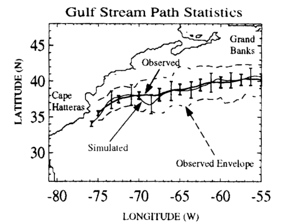
The title of that paper still resonates with us: How far from reality? In many ways, that question sits at the heart of Seatrec. Yi went on to spend roughly 20 years at NASA Jet Propulsion Laboratory working in ocean modeling and satellite oceanography before founding Seatrec in 2016. Our core technology originated at NASA JPL / Caltech, and our mission is to make the ocean more continuously observable by solving one of subsea science’s most stubborn constraints: power.
For decades, oceanographers have had to make difficult tradeoffs. Traditional profiling floats are constrained by primary batteries, which limit mission duration, sampling frequency, and payload flexibility. Satellites transformed our view of the surface ocean, but the subsurface ocean, the heat structure, salinity gradients, mixing, and soundscape, remains much harder to observe persistently. That is the gap Seatrec was built to close.
Seatrec’s answer has been to rethink power from the ocean up. Our infiniTE™ platform harvests electricity from naturally occurring temperature differences between warm surface water and colder depths. As the float cycles through the water column, phase-change materials drive a hydraulic system and generator, producing power for repeated profiling and expanded sensing. The result is a long-endurance platform designed to collect more data, more often, with less dependence on battery replacement and ship support.
This 500-profile mission shows what that looks like in practice. The mission began in the northeastern Gulf of Mexico, south of Destin, Florida. In its first 49 days, the float completed 160 profiles, diving to depths of up to 800 meters while surfacing to transmit real-time data. Equipped with a CTD and passive acoustic hydrophone, it began building a continuous picture of subsurface temperature, salinity, and underwater sound in a region where seeing below the surface matters for both hurricane forecasting and soundscape monitoring.
After 315 profiles, the float entered the Florida Straits, where the mission shifted from broad Gulf drifting to boundary-current sampling. This narrow, deep, high-energy corridor between the Florida Keys and Cuba funnels flow toward the Atlantic and sharpens vertical and horizontal gradients. In this phase, the float was completing about four profiles per day, creating a much denser record of changing subsurface conditions through one of the most dynamic passages in the western Atlantic.
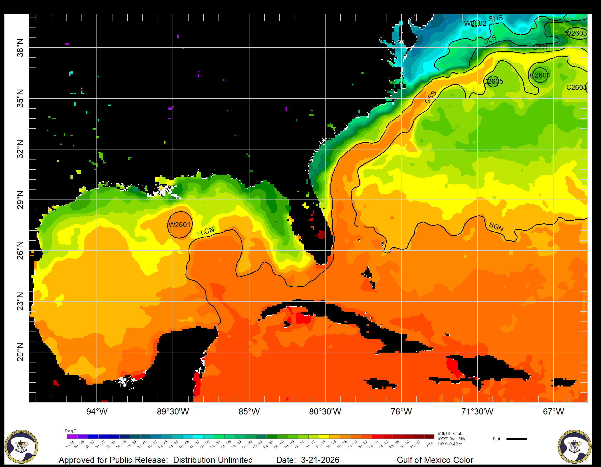
By 480 profiles, the mission had advanced from the Gulf of Mexico through the Florida Straits, up the U.S. East Coast, setting up the next chapter as the float entered the Gulf Stream separation region off Cape Hatteras, the same broader system that defined an early chapter of Yi’s scientific career. What once lived in model grids is now being sampled profile by profile by an autonomous float powered by the ocean’s own thermal gradients.
That is why this milestone feels bigger than a number. Yes, 500 profiles is an operational achievement. But it is also a reminder that the best ocean technology does more than last longer. It changes what is scientifically possible. Seatrec’s milestone is not that this is the first float to sample the Gulf Stream. It is that a thermally powered float is delivering persistent, high-frequency profiling across multiple connected ocean regimes, without the same battery limits that have historically constrained mission duration and sensor use.
Persistent subsurface measurements help reveal the hidden heat structure that can fuel hurricane rapid intensification. They support better understanding of ocean heat transport and water-column structure across connected current systems. And when acoustic sensing is added to the same long-endurance platform, they can also contribute to persistent soundscape monitoring.
For Seatrec, this is a field report. For Yi, it is a full-circle moment. Three decades after asking how far ocean models were from reality, he now leads a company building tools that can stay in that reality longer, profiling through it, transmitting from it, and helping make the ocean more continuously observable. Few scientific careers draw such a direct line from question to platform. This one does.
And the float is still going.
Live tracking: seatrec-floats.com
Data access and collaboration: info@seatrec.com

Seatrec’s infiniTE™ Profiling Float Captures First-of-Its-Kind Fine-Scale Ocean Vertical Structure
Seatrec’s infiniTE™ Profiling Float Captures First-of-Its-Kind Fine-Scale Ocean Vertical Structure, Powered by Temperature Gradients
A serendipitous meeting between ocean engineers and scientists sparked a new float mission to change how the ocean is measured
VISTA, Calif.— Feb. 23, 2026 — Seatrec, a leader in thermal-powered, long-endurance subsea drones, today announced the successful launch of a collaborative scientific mission to develop new autonomous profiling float capabilities that are powered by the ocean’s temperature differences and collect critical data on ocean health and carbon cycling.
This mission originated from a booth conversation at the American Geophysical Union (AGU)-sponsored Ocean Sciences Meeting 2024 (OSM24), held in New Orleans in February 2024. Seatrec CEO and Founder, Yi Chao, Ph.D., met with Mark Altabet, Ph.D, Professor and Chair of the School for Marine Science & Technology at the University of Massachusetts Dartmouth, and Eric A. D’Asaro, Ph.D., Senior Principal Oceanographer of the Applied Physics Laboratory and School of Oceanography at the University of Washington. At the time, Seatrec had recently launched its commercial infiniTE™ float. During discussions, Altabet and D’Asaro explored how the infiniTE float could fundamentally alter sampling strategies for studying turbulence, internal waves, and ocean mixing. That discussion marked the beginning of a co-development effort.
“Data below the ocean surface is significantly lacking because traditional profiling floats are all powered by primary batteries that limit float life and data collection capability,” explained Chao. “The infiniTE float harvests energy from temperature gradients in the ocean, and can therefore collect more frequent measurements and carry new sensors.”
The collaboration resulted in the successful development and deployment of an infiniTE float with two sensors to measure oxygen and total dissolved gas pressure (TDGP), key indicators of ecosystem health, environmental stress, and carbon cycling. The accurate measurement of TDGP requires the float to park at multiple depths and remain at each depth long enough for the sensor to collect reliable measurements.
“This type of mission has never been done before with the existing float products,” said D’Asaro. “The infiniTE float changes the way we think about power in a profiling float. In a battery-powered float, the total energy is fixed, so you try to minimize power usage by minimizing the number of profiles. Since the infiniTE float recharges its battery with the energy harvested from the ocean, there is no power penalty for more profiles.”
“Looking into the future,” said Altabet, “the infiniTE float can be used to profile more rapidly to resolve the diurnal variation of oxygen and its impact on productivity. This could only be done with the infiniTE float in a sustained way.”
This mission builds on Seatrec’s broader efforts to advance long-duration autonomous ocean systems, including a Cooperative Research and Development Agreement (CRADA) with the Naval Postgraduate School focused on enabling persistent, real-time oceanographic and acoustic measurements in open-ocean environments.
Related to this work, Chao will present at this week’s AGU Ocean Sciences Meeting in Glasgow, Scotland, on harvesting energy from ocean temperature gradients to power underwater robots and sensors for persistent monitoring.
About Seatrec
Seatrec designs and manufactures subsea drones that generate electricity from ocean temperature gradients. Our products empower defense and oceanographic researchers to extend mission durations, optimize data collection, and reduce operational costs. By enabling the integration of advanced sensors previously limited in endurance and functionality, such as hydrophones, we open new possibilities for ocean science.
Seatrec’s energy-harvesting core technology was developed at NASA’s Jet Propulsion Laboratory and spun out of the California Institute of Technology in 2016. Seatrec is headquartered in Vista, California. Visit us at seatrec.com.
About the School for Marine Science & Technology, University of Massachusetts Dartmouth
The School for Marine Science & Technology at the University of Massachusetts Dartmouth (SMAST) is a nationally and internationally recognized institution for education and research in marine science and ocean technology. SMAST is a collaborative community of dedicated students and expert faculty working together to address critical challenges in marine science while fostering a supportive and collegial environment. SMAST students and faculty help address urgent issues facing the world’s oceans, including climate change and ocean impacts, food security via sustainable fisheries, sustainable energy development and associated impacts, and coastal ecosystem resilience.
About the Applied Physics Laboratory, University of Washington
The University of Washington Applied Physics Laboratory (APL-UW) was founded by the U.S. Navy in 1943 to conduct acoustic and oceanographic studies on how deep ocean variability affects Navy systems. Today, APL-UW scientists and engineers lead research and applied technologies in acoustic and remote sensing, ocean physics and engineering, medical and industrial ultrasound, polar science and logistics, environmental and information systems, and electronic and photonic systems.
Media Contact
Marta Bulaich
Seatrec, Inc.
marta.bulaich@seatrec.com
+1 (415) 816-1665
Seatrec’s infiniTE™ Float Surpasses 1,000 Dives for Naval Postgraduate School
Seatrec’s infiniTE™ Float Surpasses 1,000 Dives for Naval Postgraduate School - Ushering a New Era of Long-Endurance Persistent Ocean Monitoring
Autonomous profiling float delivers oceanographic and acoustic data every six hours, fully powered by harvested energy from temperature gradients, marking a breakthrough in persistent, long-endurance ocean monitoring and real-time reporting for defense, scientific research, and exploration
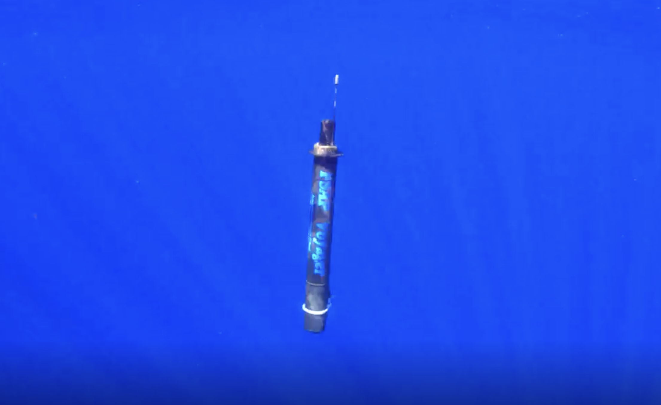
Seatrec, a leader in thermal-powered subsea drones, today announced a major milestone in oceanographic research with the 1,000th dive completed by its infiniTE™ float, deployed off the coast of Kona, Hawai’i, in collaboration with the Naval Postgraduate School (NPS). The float reached depths of 700 meters, diving into the deep sound channel for optimal listening, while producing more electricity than it consumed. The first-of-its-kind, an ocean-powered float carries a passive acoustic hydrophone, records sound data, processes data onboard, and transmits information and intelligence in real-time.
“Reaching 1,000 profiles is a critical endurance benchmark for our technology that unlocks exciting opportunities in ocean research and exploration,” explained Yi Chao, Ph.D., CEO and founder of Seatrec. “It is a significant achievement to demonstrate the capabilities of our infiniTE™ float to power multiple sensors with the energy from the ocean rather than relying on a limited battery.”
Launched on November 5, 2024, in collaboration with the NPS and funded by NPS’s Consortium for Robotics and Unmanned Systems Education and Research (CRUSER) program, this pioneering float known as the Persistent Smart Acoustic Profiler (PSAP) has harvested over 10 megajoules (2,800 Wh) of clean, renewable energy using Seatrec’s patented infiniTE™ technology, which converts natural ocean temperature gradients into electricity. Over just seven months, the infiniTE™ float has generated 2x the energy of a conventional battery-powered float while maintaining a net-positive energy balance. The harvested energy powers a Conductivity-Temperature-Depth (CTD) sensor and a passive acoustic hydrophone, onboard data processing, and satellite data transmissions, ushering in a new era of long-endurance, persistent ocean float missions.
NPS’s mission is to deliver defense-focused graduate education and interdisciplinary research to enhance the Navy’s operational effectiveness and technological leadership. “Through the Meteorology and Oceanography (METOC) program, NPS drives impactful results via innovative research and technology co-development. Our METOC student, Lieutenant Kirk Bienvenu, is analyzing PSAP data in his master’s thesis to advance maritime intelligence. By collaborating with startups like Seatrec, NPS equips officers with skills to address complex global threats, ensuring Navy readiness in dynamic operational theaters,” said John Joseph, the principal investigator and faculty associate for research at the Naval Postgraduate School.
PSAP represents an innovative way to collect and transmit oceanographic and underwater acoustic information essential to supporting critical Navy mission areas, including Undersea Warfare, Seabed Warfare, ISR and Maritime Domain Awareness. “Operating independently of other theater assets, PSAP provides a real-time feed of critical information directly to the warfighter, enhancing their tactical decision making,” Joseph said.
By combining a CTD sensor with a hydrophone, the infiniTE™ float enables simultaneous monitoring of both the ocean’s physical properties and acoustic soundscape. This breakthrough marks a turning point for persistent long-endurance, multi-sensor ocean observing missions once limited by battery constraints.
This milestone adds to a series of recent achievements by Seatrec, including:
- Selection by Sea-Bird Scientific as the exclusive manufacturer of the Navis floats for the international Argo program.
- A successful Arctic Power Station test at Michigan Tech’s Great Lakes facility.
- Recognition as a winner of the U.S. Department of Energy’s Powering the Blue Economy™: Power at Sea Prize.
As the infiniTE™ float continues to demonstrate unmatched endurance and modularity, Seatrec is accelerating its vision to deliver scalable, self-powered solutions for defense, researchers, government agencies, and industry partners operating across the world’s oceans.
About Seatrec
Seatrec designs and manufactures subsea drones that generate electricity from ocean temperature gradients. Our products empower defense and oceanographic researchers to extend mission durations, optimize data collection, and reduce operational costs. By enabling the integration of advanced sensors previously limited in endurance and functionality, such as hydrophones, we open new possibilities for ocean science. Seatrec’s energy harvesting core technology was developed at NASA’s Jet Propulsion Laboratory and spun out of the California Institute of Technology in 2016. Seatrec is headquartered in Vista, California. Visit us at seatrec.com.
About the Naval Postgraduate School
The Naval Postgraduate School is a defense-focused graduate university offering master’s and doctoral degrees in fields of study core to Naval-unique needs, the U.S. Armed Forces, DOD civilians and international partners. For information, visit: nps.edu.
Media Contact
Marta Bulaich
Seatrec, Inc.
marta.bulaich@seatrec.com
+1 (415) 816-1665

Seatrec Wins Exclusive License from Sea-Bird Scientific to Manufacture Floats for Argo to Monitor the Global Ocean
Seatrec Wins Exclusive License from Sea-Bird Scientific to Manufacture Floats for Argo - An International Program to Monitor the Global Ocean
Seatrec selected in competitive RFP for its revolutionary advancement in ocean monitoring capabilities with its sustainable and renewable energy harvesting system
VISTA, Calif. (May 8, 2025) Seatrec, an underwater drone company, and Sea-Bird Scientific, a leading provider of oceanographic sensors and instrumentation, today announced an exclusive licensing agreement that Seatrec will manufacture Sea-Bird Scientific’s Navis floats for Argo, an international program to monitor the global ocean.
"Our mission is to monitor the ocean on a global scale,” explained Yi Chao, Ph.D., CEO and founder of Seatrec. “This agreement with Sea-Bird makes Seatrec a key provider of autonomous profiling floats to the international Argo program, especially with biogeochemical (BGC) sensors to monitor ocean ecosystems and health."
Under the terms of the agreement, Seatrec will receive exclusive rights to manufacture Sea-Bird Scientific’s Navis float product line. This strategic partnership is expected to combine the strong sensor expertise at Sea-Bird Scientific and the innovative float platform at Seatrec to provide continuous support to the international Argo Program and open new market opportunities that benefit both companies.
"This collaboration with Seatrec represents a significant step in our commitment to providing best-in-class oceanographic sensor solutions," said Jessica Pounds, President of Sea-Bird Scientific. “As we continue to focus on driving innovation in sensors and instrumentation for the entire oceanographic community, we look forward to our partnership with Seatrec to deliver industry-leading float technology to support the emerging BGC Argo Program.”
Seatrec, a dual-use deep tech startup, is the leader in the temperature-powered infiniTE™ float. Powered by a patented technology that harvests energy from ocean temperature differences, the infiniTE™ float can increase ocean data collection by up to 40 times (reducing the Argo float sampling interval of 10 days to every six hours) compared to traditional battery-powered floats, opening new possibilities for power-intensive sensors such as passive acoustic hydrophones for soundscape monitoring, addressing critical challenges in ocean science and defense applications.
Seatrec expects to take purchase orders of Navis floats in early 2026 and begin rolling out the fully integrated Navis floats with customer-requested sensors by late 2026.
About Seatrec
Seatrec designs and manufactures subsea drones that generate electricity from ocean temperature gradients. Our products empower oceanographic researchers to extend mission durations, optimize data collection, and reduce costs. By enabling the integration of advanced sensors previously limited by power constraints, such as hydrophones, we unlock new possibilities for ocean science. The core technology was developed at the NASA Jet Propulsion Laboratory. Seatrec was incorporated in 2016 as a spinoff from the California Institute of Technology. The company is headquartered in Vista, CA. Visit us at seatrec.com.
About Sea-Bird Scientific
Sea-Bird Scientific exists to help scientists know the world — and shape policy that changes it for the better. As one of the global leaders in oceanographic instrumentation, their customers work on the leading edge of ocean science. Their results break the frontiers of what we know about natural waters and contribute to our understanding of climate change, ecosystem health, and more. From optical sensors to observational systems, they possess an expansive portfolio of accurate instrumentation that ensures we are powering science-based decisions for a better ocean. The company is based in Bellevue, Washington. Visit us at www.seabird.com.
Media Contacts:
Marta Bulaich